Geolocate

Carnforth topographic map

Click on the map to display elevation.

About this map
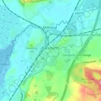
Name: Carnforth topographic map, elevation, terrain.

Location: Carnforth, Warton, Lancaster, Lancashire, England, United Kingdom (54.11237 -2.79634 54.14223 -2.73563)

Average elevation: 92 ft

Minimum elevation: 0 ft

Maximum elevation: 456 ft

Other topographic maps

Click on a map to view its topography, its elevation and its terrain.
Warton Crag

United Kingdom > England > Lancashire > Lancaster > Warton

Average elevation: 148 ft

Gear up for your next adventure:

🏕️Tent Footprint - Protect your tent base from wear
🩹Survival Bandages - High‑quality bandages for emergencies
🛰️Satellite Messengers - Emergency SOS and two-way messaging for off-grid adventures
🪶Compact Camp Shovel - Folding shovel for campsite tasks
🕶️Glacier Sunglasses - Side shields to protect eyes from high-altitude snow glare

As an Amazon Associate, this site earns from qualifying purchases at no extra cost to you.