Geolocate

Rock Hill topographic map

Click on the map to display elevation.

About this map

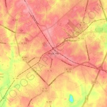
Name: Rock Hill topographic map, elevation, terrain.

Location: Rock Hill, York County, South Carolina, 29731, United States (34.88487 -81.06508 34.96487 -80.98508)

Average elevation: 607 ft

Minimum elevation: 374 ft

Maximum elevation: 699 ft

York County trails, hiking, mountain biking, running and outdoor activities

Gear up for your next adventure:

🛡️Bear Spray Outdoor - Protection in bear country hikes
🪶Multi‑Purpose Knife - Useful blade for camp and trail
🪶Thermal Camp Blanket - Extra warmth for cold nights
🔦Powerful Headlamps - Ultra-bright hands-free lighting for night navigation
🔊Portable Camp Speaker - Music and alerts at camp

As an Amazon Associate, this site earns from qualifying purchases at no extra cost to you.