
Saincaize-Meauce topographic map
Interactive map
Click on the map to display elevation.
About this map
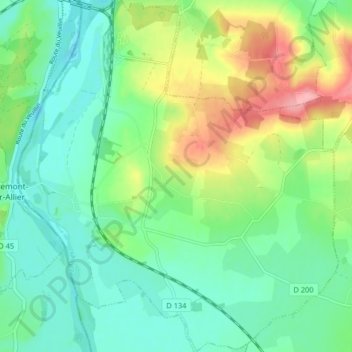
Name: Saincaize-Meauce topographic map, elevation, terrain.
Average elevation: 653 ft
Minimum elevation: 538 ft
Maximum elevation: 892 ft
Other topographic maps
Click on a map to view its topography, its elevation and its terrain.
Le Sallay
France > Bourgogne-Franche-Comté > Nièvre > Saincaize-Meauce > Le Sallay
Le Sallay, Saincaize-Meauce, Nevers, Nièvre, Bourgogne-Franche-Comté, France métropolitaine, 58470, France
Average elevation: 712 ft