
Send topographic map
Click on the map to display elevation.
About this map
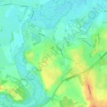
Name: Send topographic map, elevation, terrain.
Location: Send, Guildford, Surrey, England, United Kingdom (51.26676 -0.54921 51.30436 -0.49931)
Average elevation: 105 ft
Minimum elevation: 62 ft
Maximum elevation: 184 ft
Other topographic maps
Click on a map to view its topography, its elevation and its terrain.
Tillingbourne Trout Farm and Smokery
United Kingdom > England > Surrey > Guildford > Shere
Average elevation: 404 ft
Gunpowder Mills Fishery
United Kingdom > England > Surrey > Guildford > Chilworth
Average elevation: 276 ft