
Thank you for supporting this site ❤️
Make a donation
Make a donation
Gear up for your next adventure:
As an Amazon Associate, this site earns from qualifying purchases at no extra cost to you.
Artemus topographic map
Click on the map to display elevation.
Thank you for supporting this site ❤️
Make a donation
Make a donation
Gear up for your next adventure:
As an Amazon Associate, this site earns from qualifying purchases at no extra cost to you.
About this map
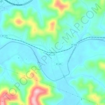
Name: Artemus topographic map, elevation, terrain.
Location: Artemus, Knox County, Kentucky, 40903, United States (36.81342 -83.86159 36.85342 -83.82159)
Average elevation: 1,132 ft
Minimum elevation: 955 ft
Maximum elevation: 1,742 ft
Knox County trails, hiking, mountain biking, running and outdoor activities
Thank you for supporting this site ❤️
Make a donation
Make a donation
Gear up for your next adventure:
As an Amazon Associate, this site earns from qualifying purchases at no extra cost to you.