
Make a donation
Gear up for your next adventure:
As an Amazon Associate, this site earns from qualifying purchases at no extra cost to you.
Totenkopf topographic map
Click on the map to display elevation.
Make a donation
Gear up for your next adventure:
As an Amazon Associate, this site earns from qualifying purchases at no extra cost to you.
Totenkopf
Der Gipfel des Totenkopfs besteht aus zwei annähernd gleich hohen Kuppen, deren Gipfel etwa 170 m voneinander entfernt liegen. Auf der etwas höheren Westkuppe befindet sich ein historischer Vermessungsstein und unweit südwestlich davon der Fernmeldeturm Vogtsburg-Totenkopf. Auf der Ostkuppe der Erhebung, dem Neunlinden-Buck (555 m ü. NHN), steht der Neunlindenturm, ein 1900 errichteter 14 m hoher Aussichtsturm, von dem die Aussicht zum Beispiel zum Schwarzwald genossen werden kann.(Lage48.0808333333337.6725)
Make a donation
Gear up for your next adventure:
As an Amazon Associate, this site earns from qualifying purchases at no extra cost to you.
About this map
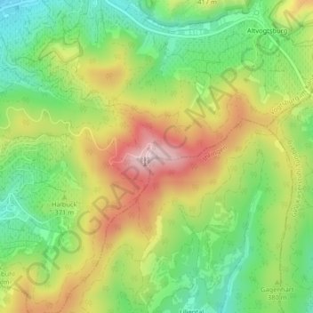
Name: Totenkopf topographic map, elevation, terrain.
Average elevation: 1,224 ft
Minimum elevation: 787 ft
Maximum elevation: 1,778 ft
Make a donation
Gear up for your next adventure:
As an Amazon Associate, this site earns from qualifying purchases at no extra cost to you.