Geolocate

Minnesund topographic map

Click on the map to display elevation.

About this map

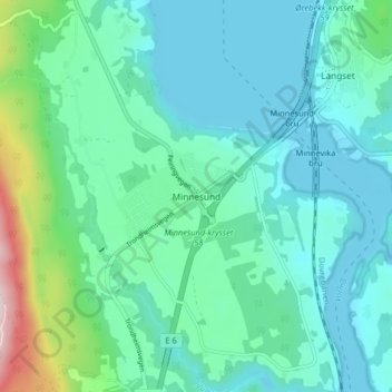
Name: Minnesund topographic map, elevation, terrain.

Location: Minnesund, Eidsvoll, Akershus, 2092, Norway (60.37150 11.19333 60.41150 11.23333)

Average elevation: 610 ft

Minimum elevation: 390 ft

Maximum elevation: 1,598 ft

Other topographic maps

Click on a map to view its topography, its elevation and its terrain.

Lunner

Norway > Akershus

Average elevation: 1,499 ft

Gear up for your next adventure:

🧭Map Reading Tools - Tools and kits for map navigation
🔪Outdoor Multitools - Essential survival tools for gear repair and field use
🩹Survival Bandages - High‑quality bandages for emergencies
📚USA Hiking Guide Books - Top trail guides and map books
📦Dry Bags Set - Waterproof storage for electronics and clothes

As an Amazon Associate, this site earns from qualifying purchases at no extra cost to you.