Geolocate

Greenville topographic map

Click on the map to display elevation.

About this map

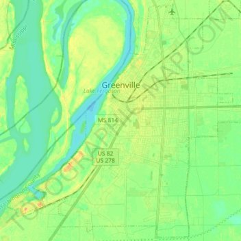
Name: Greenville topographic map, elevation, terrain.

Location: Greenville, Washington County, Mississippi, United States (33.33589 -91.13123 33.45111 -90.98903)

Average elevation: 118 ft

Minimum elevation: 82 ft

Maximum elevation: 174 ft

Washington County trails, hiking, mountain biking, running and outdoor activities

Gear up for your next adventure:

🌡️Portable Weather Meter - Track weather conditions on the trail
🚗GPS Dash Cams - Record your scenic drives through mountain passes and canyons
🪶Camping Sleeping Pad - Comfortable sleeping pad for backpacking
⛑️Personal Locator Beacon - Safety beacon for emergencies
🪄Magnetic Compass - Accurate compass for navigation

As an Amazon Associate, this site earns from qualifying purchases at no extra cost to you.