
Thank you for supporting this site ❤️
Make a donation
Make a donation
Gear up for your next adventure:
As an Amazon Associate, this site earns from qualifying purchases at no extra cost to you.
Cartiera-Stazione topographic map
Click on the map to display elevation.
Thank you for supporting this site ❤️
Make a donation
Make a donation
Gear up for your next adventure:
As an Amazon Associate, this site earns from qualifying purchases at no extra cost to you.
About this map
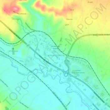
Name: Cartiera-Stazione topographic map, elevation, terrain.
Location: Cartiera-Stazione, Ferentino, Frosinone, Lazio, 03013, Italy (41.63221 13.22701 41.67221 13.26701)
Average elevation: 561 ft
Minimum elevation: 443 ft
Maximum elevation: 827 ft
Thank you for supporting this site ❤️
Make a donation
Make a donation
Gear up for your next adventure:
As an Amazon Associate, this site earns from qualifying purchases at no extra cost to you.