

Chalets De Lessy topographic map
Click on the map to display elevation.
About this map
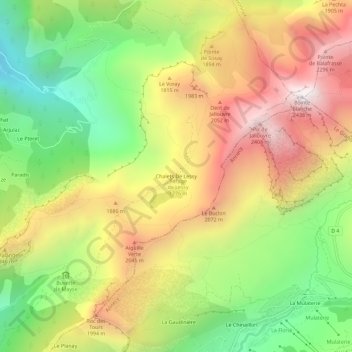
Name: Chalets De Lessy topographic map, elevation, terrain.
Average elevation: 5,377 ft
Minimum elevation: 3,041 ft
Maximum elevation: 7,887 ft
Other topographic maps
Click on a map to view its topography, its elevation and its terrain.
Plateau des Glières
France > Auvergne-Rhône-Alpes > Haute-Savoie > Glières-Val-de-Borne
Le plateau des Glières est un val perché encadré par la montagne des Auges (1 822 mètres), la crête des Ovines (pointe de la Québlette, 1 915 mètres) et la montagne des Frêtes (1 910 mètres). L'altitude moyenne est de 1 450 mètres. Le plateau est délimité à l'est par la vallée du Borne, au…
Average elevation: 4,941 ft