Geolocate

Le Grange topographic map

Click on the map to display elevation.

About this map

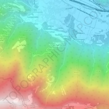
Name: Le Grange topographic map, elevation, terrain.

Location: Le Grange, Villar Focchiardo, Torino, Piedmont, Italy (45.07576 7.21514 45.11576 7.25514)

Average elevation: 2,989 ft

Minimum elevation: 1,243 ft

Maximum elevation: 6,243 ft

Gear up for your next adventure:

🧥Men's Rain Shells - Premium waterproof and breathable jackets for mountain weather
🛌Ultralight Sleeping Bags - Compact down bags for cold nights in the wilderness
👟Trail Running Shoes - Lightweight shoes for trail runners
🔦LED Headlamp - Bright and durable LED headlamp for night navigation
🌎3D Topographic Globes - Raised relief globes for a tactile understanding of geography

As an Amazon Associate, this site earns from qualifying purchases at no extra cost to you.