
Dhanbad topographic map
Click on the map to display elevation.
Dhanbad
Dhanbad has an average elevation of 227 m (745 ft). Its geographical length (extending from north to south) is 15 miles (24 km) and the breadth (stretching across east to West) is 10 miles (16 km). It shares its boundaries with West Bengal in the eastern and southern part, Giridih and Dumka in the North and Bokaro District in the west. Dhanbad comes under the Chota Nagpur Plateau.
About this map
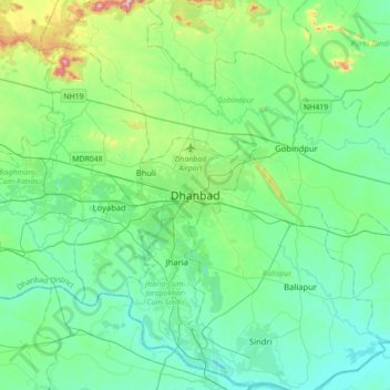
Name: Dhanbad topographic map, elevation, terrain.
Average elevation: 696 ft
Minimum elevation: 371 ft
Maximum elevation: 2,077 ft