
Thank you for supporting this site ❤️
Make a donation
Make a donation
Gear up for your next adventure:
As an Amazon Associate, this site earns from qualifying purchases at no extra cost to you.
Serravalle topographic map
Click on the map to display elevation.
Thank you for supporting this site ❤️
Make a donation
Make a donation
Gear up for your next adventure:
As an Amazon Associate, this site earns from qualifying purchases at no extra cost to you.
About this map
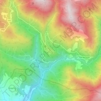
Name: Serravalle topographic map, elevation, terrain.
Location: Serravalle, Bibbiena, Arezzo, Toscana, 52014, Italia (43.75428 11.82181 43.79428 11.86181)
Average elevation: 2,644 ft
Minimum elevation: 1,467 ft
Maximum elevation: 4,012 ft
Thank you for supporting this site ❤️
Make a donation
Make a donation
Gear up for your next adventure:
As an Amazon Associate, this site earns from qualifying purchases at no extra cost to you.