Geolocate

Varna topographic map

Click on the map to display elevation.

About this map

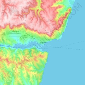
Name: Varna topographic map, elevation, terrain.

Location: Varna, 9000, Bulgaria (43.04739 27.75667 43.36739 28.07667)

Average elevation: 371 ft

Minimum elevation: -3 ft

Maximum elevation: 1,207 ft

Gear up for your next adventure:

🧭GPS Watch Accessories - Bands and chargers for GPS watches
📌Outdoor GPS Map App - Apps and devices for digital topographic navigation
GPS Sports Watch - GPS watch for running, hiking and training
🥾Women's Hiking Boots - Top-rated trail boots with ankle support and superior grip
🦺Reflective Outdoor Gear - Safety gear for low‑light conditions

As an Amazon Associate, this site earns from qualifying purchases at no extra cost to you.