Geolocate

Pavona topographic map

Click on the map to display elevation.

About this map

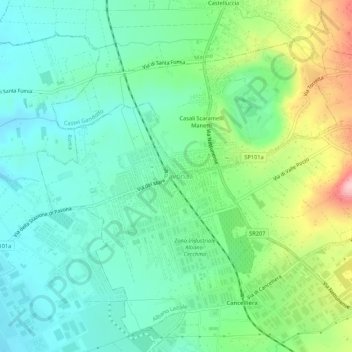
Name: Pavona topographic map, elevation, terrain.

Location: Pavona, Albano Laziale, Roma Capitale, Lazio, 00041, Italy (41.70460 12.59163 41.74460 12.63163)

Average elevation: 617 ft

Minimum elevation: 423 ft

Maximum elevation: 1,089 ft

Gear up for your next adventure:

🪶LED Camping Lantern - Bright lantern for camp lighting
🎒Day Hiking Backpack - Lightweight backpack perfect for day trips and outdoor adventures
🧢Outdoor Hiking Hat - Sun protection hat for outdoor explorers
Solar GPS Watches - Advanced multisport watches with built-in topographic maps
🚁Photography Drones - Capture stunning aerial views of landforms and topography

As an Amazon Associate, this site earns from qualifying purchases at no extra cost to you.