
Make a donation
Gear up for your next adventure:
As an Amazon Associate, this site earns from qualifying purchases at no extra cost to you.
Arcadia topographic map
Click on the map to display elevation.
Make a donation
Gear up for your next adventure:
As an Amazon Associate, this site earns from qualifying purchases at no extra cost to you.
Arcadia
Arcadia is a town in, and the parish seat of, Bienville Parish in northern Louisiana, United States. The population was 2,919 at the 2010 census. Arcadia has the highest elevation of any incorporated municipality in Louisiana. Arcadia's name commemorates the Ancient Greek region of Arcadia.
Make a donation
Gear up for your next adventure:
As an Amazon Associate, this site earns from qualifying purchases at no extra cost to you.
About this map
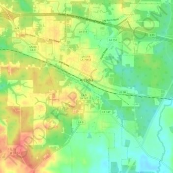
Name: Arcadia topographic map, elevation, terrain.
Location: Arcadia, Bienville Parish, Louisiana, United States (32.52298 -92.94822 32.57125 -92.90405)
Average elevation: 361 ft
Minimum elevation: 269 ft
Maximum elevation: 463 ft
Make a donation
Gear up for your next adventure:
As an Amazon Associate, this site earns from qualifying purchases at no extra cost to you.