Geolocate

Al Hanuvil topographic map

Click on the map to display elevation.

About this map

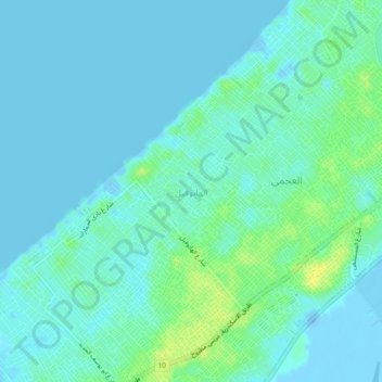
Name: Al Hanuvil topographic map, elevation, terrain.

Location: Al Hanuvil, Alexandria, 21575, Egypt (31.09139 29.74500 31.13139 29.78500)

Average elevation: 16 ft

Minimum elevation: -82 ft

Maximum elevation: 59 ft

Gear up for your next adventure:

📚USA Hiking Guide Books - Top trail guides and map books
🌐World Map Poster - Decorative world maps with topographic info
🏔️Mountain Trail Maps - High‑detail maps for popular peaks
👖Convertible Hiking Pants - Versatile zip-off pants for changing altitudes and temperatures
👟Trail Running Shoes - Lightweight shoes for trail runners

As an Amazon Associate, this site earns from qualifying purchases at no extra cost to you.