
马陵山 topographic map
Interactive map
Click on the map to display elevation.
About this map
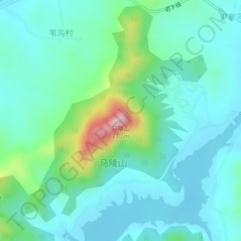
Name: 马陵山 topographic map, elevation, terrain.
Location: 马陵山, 日照市, 山东省, 276800, 中国 (35.51012 119.39538 35.51022 119.39548)
Average elevation: 358 ft
Minimum elevation: 157 ft
Maximum elevation: 1,145 ft
Other topographic maps
Click on a map to view its topography, its elevation and its terrain.