Geolocate

Onno topographic map

Click on the map to display elevation.

About this map

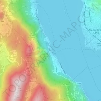
Name: Onno topographic map, elevation, terrain.

Location: Onno, Oliveto Lario, Lecco, Lombardia, 23865, Italia (45.89153 9.27345 45.93153 9.31345)

Average elevation: 1,486 ft

Minimum elevation: 623 ft

Maximum elevation: 3,550 ft

Gear up for your next adventure:

🧥Men's Rain Shells - Premium waterproof and breathable jackets for mountain weather
🗺️NatGeo Topo Maps - High-quality waterproof printed topographic maps of US Parks
📌Outdoor GPS Map App - Apps and devices for digital topographic navigation
🪵Folding Camp Saw - Compact saw for wood and campsite work
👓Polarized Sunglasses - Outdoor sunglasses for glare reduction

As an Amazon Associate, this site earns from qualifying purchases at no extra cost to you.