
Make a donation
Gear up for your next adventure:
As an Amazon Associate, this site earns from qualifying purchases at no extra cost to you.
La Coupière topographic map
Click on the map to display elevation.
Make a donation
Gear up for your next adventure:
As an Amazon Associate, this site earns from qualifying purchases at no extra cost to you.
About this map
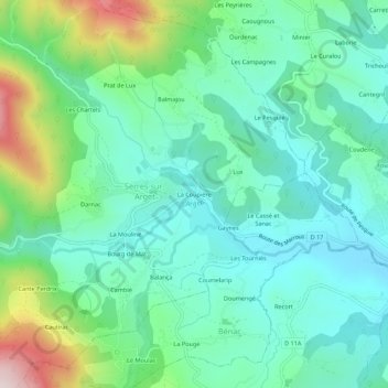
Name: La Coupière topographic map, elevation, terrain.
Average elevation: 1,896 ft
Minimum elevation: 1,476 ft
Maximum elevation: 3,127 ft
Make a donation
Gear up for your next adventure:
As an Amazon Associate, this site earns from qualifying purchases at no extra cost to you.
Other topographic maps
Click on a map to view its topography, its elevation and its terrain.
L'Arget
France > Occitanie > Ariège > Serres-sur-Arget
De 23,1 km de longueur, l'Arget prend sa source dans les Pyrénées vers 1 600 m d'altitude près du Sarrat Froid dans le massif Nord-Pyrénéen de l'Arize, et se jette dans l'Ariège en rive gauche au pied du château de Foix. La vallée de l'Arget est appelée la Barguillière.
Average elevation: 2,874 ft