
因揭陀山 topographic map
Interactive map
Click on the map to display elevation.
About this map
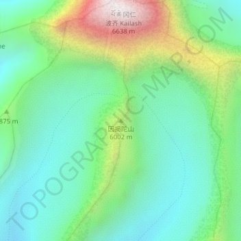
Name: 因揭陀山 topographic map, elevation, terrain.
Location: 因揭陀山, 巴噶乡, 普兰县, 阿里地区, 西藏自治区, 中国 (31.05483 81.31237 31.05493 81.31247)
Average elevation: 18,855 ft
Minimum elevation: 17,703 ft
Maximum elevation: 21,604 ft
Other topographic maps
Click on a map to view its topography, its elevation and its terrain.