
Greendale topographic map
Click on the map to display elevation.
About this map
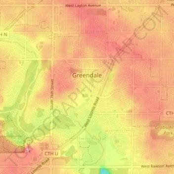
Name: Greendale topographic map, elevation, terrain.
Location: Greendale, Milwaukee County, Wisconsin, 53129, United States (42.91974 -88.03012 42.95499 -87.96657)
Average elevation: 761 ft
Minimum elevation: 531 ft
Maximum elevation: 879 ft
Milwaukee County trails, hiking, mountain biking, running and outdoor activities
Other topographic maps
Click on a map to view its topography, its elevation and its terrain.