
Make a donation
Gear up for your next adventure:
As an Amazon Associate, this site earns from qualifying purchases at no extra cost to you.
Nieder-Oberrod topographic map
Click on the map to display elevation.
Make a donation
Gear up for your next adventure:
As an Amazon Associate, this site earns from qualifying purchases at no extra cost to you.
About this map
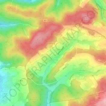
Name: Nieder-Oberrod topographic map, elevation, terrain.
Average elevation: 1,289 ft
Minimum elevation: 991 ft
Maximum elevation: 1,572 ft
Make a donation
Gear up for your next adventure:
As an Amazon Associate, this site earns from qualifying purchases at no extra cost to you.
Other topographic maps
Click on a map to view its topography, its elevation and its terrain.
Heftrich
Deutschland > Hessen > Rheingau-Taunus-Kreis > Idstein
Heftrich liegt östlich der Kernstadt Idstein in einer Talmulde im Quellgebiet des Schlabachs, einem linken südlichen Zufluss des Emsbachs bei Esch, an der Wasserscheide zwischen Lahn und Main im östlichen Hintertaunus. Auf dieser Wasserscheide im Süden der Gemarkung verläuft der Römische Limes. Hier…
Average elevation: 1,175 ft
Make a donation
Gear up for your next adventure:
As an Amazon Associate, this site earns from qualifying purchases at no extra cost to you.