
Town of Jefferson topographic map
Interactive map
Click on the map to display elevation.
About this map
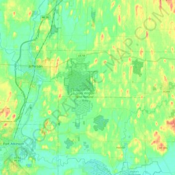
Name: Town of Jefferson topographic map, elevation, terrain.
Average elevation: 827 ft
Minimum elevation: 764 ft
Maximum elevation: 958 ft
Jefferson County trails, hiking, mountain biking, running and outdoor activities
Other topographic maps
Click on a map to view its topography, its elevation and its terrain.
Aztalan State Park
United States > Wisconsin > Jefferson County > Town of Aztalan
Average elevation: 837 ft