Geolocate

Moulin topographic map

Click on the map to display elevation.

About this map

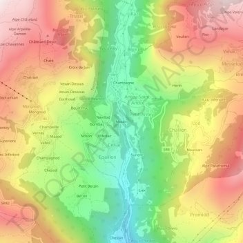
Name: Moulin topographic map, elevation, terrain.

Location: Moulin, Ruvere, Antey-Saint-André, Aosta Valley, 11020, Italy (45.78113 7.56913 45.82113 7.60913)

Average elevation: 4,626 ft

Minimum elevation: 2,618 ft

Maximum elevation: 6,637 ft

Gear up for your next adventure:

🥄Camping Utensil Set - Lightweight utensils for outdoor meals
🚁Photography Drones - Capture stunning aerial views of landforms and topography
🧴Hand Sanitizer - Keep hands clean while hiking
🧯Portable Fire Pit - Compact fire pit for camping spots
🥩Freeze-Dried Meals - Nutritious and lightweight food for remote expeditions

As an Amazon Associate, this site earns from qualifying purchases at no extra cost to you.