
泾县 topographic map
Interactive map
Click on the map to display elevation.
About this map
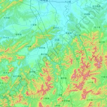
Name: 泾县 topographic map, elevation, terrain.
Location: 泾县, 宣城市, 安徽省, 242540, 中国 (30.37116 117.96230 30.85266 118.66962)
Average elevation: 702 ft
Minimum elevation: 26 ft
Maximum elevation: 3,698 ft
Other topographic maps
Click on a map to view its topography, its elevation and its terrain.