
Thank you for supporting this site ❤️
Make a donation
Make a donation
Gear up for your next adventure:
As an Amazon Associate, this site earns from qualifying purchases at no extra cost to you.
Chana topographic map
Click on the map to display elevation.
Thank you for supporting this site ❤️
Make a donation
Make a donation
Gear up for your next adventure:
As an Amazon Associate, this site earns from qualifying purchases at no extra cost to you.
About this map
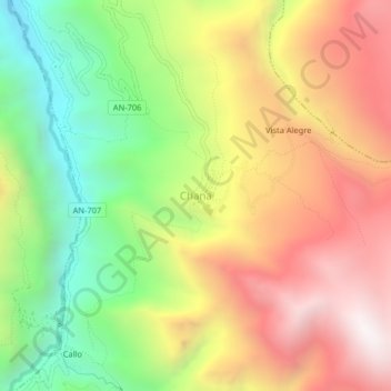
Name: Chana topographic map, elevation, terrain.
Location: Chana, San Pedro de Chaná, Huari, Áncash, Perú (-9.42328 -77.03126 -9.38328 -76.99126)
Average elevation: 11,302 ft
Minimum elevation: 8,927 ft
Maximum elevation: 13,724 ft
Thank you for supporting this site ❤️
Make a donation
Make a donation
Gear up for your next adventure:
As an Amazon Associate, this site earns from qualifying purchases at no extra cost to you.