
Lancaster topographic map
Click on the map to display elevation.
Lancaster
Lancaster is located at 42°50′55″N 90°42′38″W / 42.848505°N 90.710430°W / 42.848505; -90.710430 (42.848505, −90.710430). Lancaster is located in the unglaciated "Driftless Area" of southwest Wisconsin whose topography is strikingly different from that of the rest of the state.
About this map
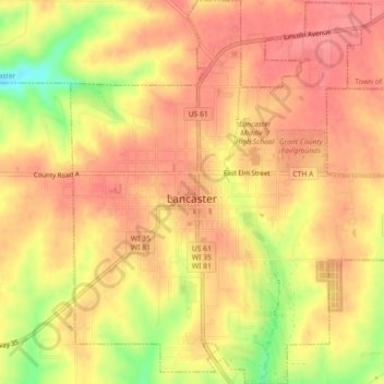
Name: Lancaster topographic map, elevation, terrain.
Location: Lancaster, Grant County, Wisconsin, 53813, United States (42.83186 -90.72446 42.86471 -90.68463)
Average elevation: 1,070 ft
Minimum elevation: 899 ft
Maximum elevation: 1,145 ft
Grant County trails, hiking, mountain biking, running and outdoor activities
Other topographic maps
Click on a map to view its topography, its elevation and its terrain.