Geolocate

Hartest topographic map

Click on the map to display elevation.

About this map

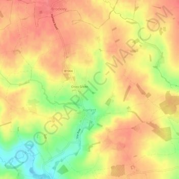
Name: Hartest topographic map, elevation, terrain.

Location: Hartest, Babergh, Suffolk, England, United Kingdom (52.12917 0.65482 52.16105 0.70463)

Average elevation: 272 ft

Minimum elevation: 138 ft

Maximum elevation: 348 ft

Other topographic maps

Click on a map to view its topography, its elevation and its terrain.

Sudbury

United Kingdom > England > Suffolk > Babergh > Sudbury

Average elevation: 177 ft

Gear up for your next adventure:

🦶Hiking Gaiters - Keep debris and water out of your boots
🔭Telescopic Hiking Pole - Adjustable pole for hiking stability
🧦Merino Wool Socks - Moisture-wicking, blister-preventing socks for long treks
🕶️Glacier Sunglasses - Side shields to protect eyes from high-altitude snow glare
🔦LED Headlamp - Bright and durable LED headlamp for night navigation

As an Amazon Associate, this site earns from qualifying purchases at no extra cost to you.