
Thank you for supporting this site ❤️
Make a donation
Make a donation
Gear up for your next adventure:
As an Amazon Associate, this site earns from qualifying purchases at no extra cost to you.
Radinkendorf topographic map
Click on the map to display elevation.
Thank you for supporting this site ❤️
Make a donation
Make a donation
Gear up for your next adventure:
As an Amazon Associate, this site earns from qualifying purchases at no extra cost to you.
About this map
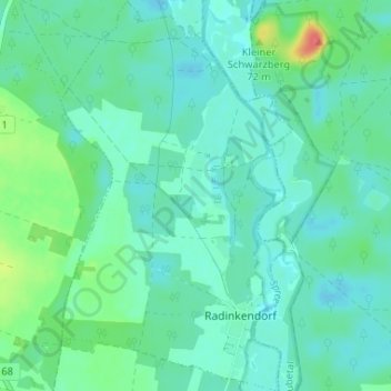
Name: Radinkendorf topographic map, elevation, terrain.
Location: Radinkendorf, Beeskow, Oder-Spree, Brandenburg, Deutschland (52.20377 14.23966 52.24371 14.27706)
Average elevation: 157 ft
Minimum elevation: 118 ft
Maximum elevation: 299 ft
Thank you for supporting this site ❤️
Make a donation
Make a donation
Gear up for your next adventure:
As an Amazon Associate, this site earns from qualifying purchases at no extra cost to you.