
Tacolneston topographic map
Click on the map to display elevation.
About this map
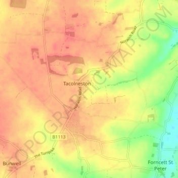
Name: Tacolneston topographic map, elevation, terrain.
Location: Tacolneston, South Norfolk, Norfolk, England, United Kingdom (52.49896 1.12272 52.52072 1.19101)
Average elevation: 174 ft
Minimum elevation: 62 ft
Maximum elevation: 230 ft
Other topographic maps
Click on a map to view its topography, its elevation and its terrain.
Forncett End
United Kingdom > England > Norfolk > South Norfolk > Tacolneston
Average elevation: 174 ft