
Thank you for supporting this site ❤️
Make a donation
Make a donation
Gear up for your next adventure:
As an Amazon Associate, this site earns from qualifying purchases at no extra cost to you.
Travecchia topographic map
Click on the map to display elevation.
Thank you for supporting this site ❤️
Make a donation
Make a donation
Gear up for your next adventure:
As an Amazon Associate, this site earns from qualifying purchases at no extra cost to you.
About this map
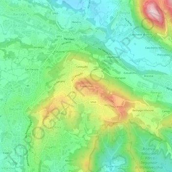
Name: Travecchia topographic map, elevation, terrain.
Location: Travecchia, Ca' Nova, Sirtori, Lecco, Lombardy, 23896, Italy (45.71873 9.31644 45.75873 9.35644)
Average elevation: 1,270 ft
Minimum elevation: 902 ft
Maximum elevation: 2,037 ft
Thank you for supporting this site ❤️
Make a donation
Make a donation
Gear up for your next adventure:
As an Amazon Associate, this site earns from qualifying purchases at no extra cost to you.