Geolocate

Exmouth topographic map

Click on the map to display elevation.

About this map

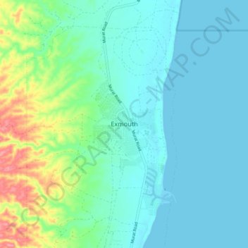
Name: Exmouth topographic map, elevation, terrain.

Location: Exmouth, Western Australia, 6707, Australia (-21.97244 114.08581 -21.89244 114.16581)

Average elevation: 69 ft

Minimum elevation: 0 ft

Maximum elevation: 335 ft

Gear up for your next adventure:

👖Convertible Hiking Pants - Versatile zip-off pants for changing altitudes and temperatures
📌Outdoor GPS Map App - Apps and devices for digital topographic navigation
🥇GPS Hiking Watch - Multi‑sport GPS watch with navigation and trail tracking
🧣Merino Neck Gaiters - Multi-functional headwear for wind and sun protection
🕶️GPS Smartphone Mount - Secure mount for phone navigation

As an Amazon Associate, this site earns from qualifying purchases at no extra cost to you.