Geolocate

Rio Pao topographic map

Click on the map to display elevation.

About this map

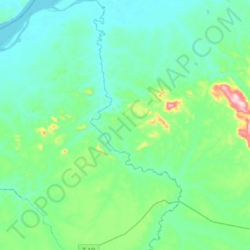
Name: Rio Pao topographic map, elevation, terrain.

Location: Rio Pao, Municipio Sucre, Estado Bolívar, Venezuela (7.46049 -64.65190 7.72815 -64.55352)

Average elevation: 295 ft

Minimum elevation: 39 ft

Maximum elevation: 1,598 ft

Other topographic maps

Click on a map to view its topography, its elevation and its terrain.

Maripa

Venezuela > Estado Bolívar > Municipio Sucre

Average elevation: 108 ft

Peramanal

Venezuela > Estado Bolívar > Municipio Sucre

Average elevation: 512 ft

Moitaco

Venezuela > Estado Bolívar > Municipio Sucre

Average elevation: 102 ft

Gear up for your next adventure:

🪄Magnetic Compass - Accurate compass for navigation
🛰️Handheld GPS Units - Professional satellite navigators for precise backcountry mapping
🍳Camping Cook Set - Complete cookware for outdoor meals
🧦Merino Wool Socks - Moisture-wicking, blister-preventing socks for long treks
🥘Titanium Cookware - Durable, featherlight pots and pans for backpacking

As an Amazon Associate, this site earns from qualifying purchases at no extra cost to you.