Geolocate

Olmos Basin Park topographic map

Click on the map to display elevation.

About this map

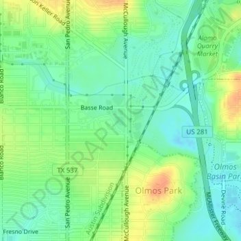
Name: Olmos Basin Park topographic map, elevation, terrain.

Location: Olmos Basin Park, San Antonio, Bexar County, Texas, USA (29.48531 -98.49687 29.48805 -98.49179)

Average elevation: 745 ft

Minimum elevation: 696 ft

Maximum elevation: 814 ft

Gear up for your next adventure:

🧣Merino Neck Gaiters - Multi-functional headwear for wind and sun protection
🧼Biodegradable Camping Soap - Eco‑friendly soap for outdoor hygiene
🔋Rechargeable Batteries - Power up your outdoor devices
🥘Titanium Cookware - Durable, featherlight pots and pans for backpacking
🚁Photography Drones - Capture stunning aerial views of landforms and topography

As an Amazon Associate, this site earns from qualifying purchases at no extra cost to you.