Geolocate

Gigante topographic map

Click on the map to display elevation.

About this map

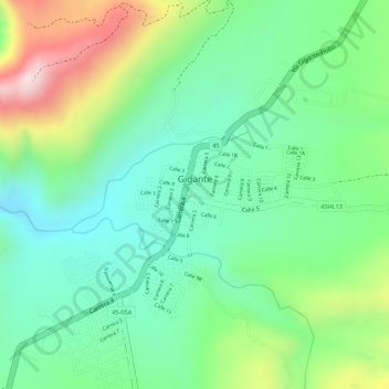
Name: Gigante topographic map, elevation, terrain.

Location: Gigante, Centro, Huila, Colombia (2.38323 -75.55103 2.39089 -75.53666)

Average elevation: 2,828 ft

Minimum elevation: 2,385 ft

Maximum elevation: 3,642 ft

Gear up for your next adventure:

🥾Men's Hiking Boots - Durable, waterproof footwear for rugged terrain and steep inclines
🎒Outdoor Daypacks - Lightweight backpacks designed for carrying maps and essential gear
🚗GPS Dash Cams - Record your scenic drives through mountain passes and canyons
🪶Paracord Bracelet - Survival bracelet with built‑in tools
🧴Hand Sanitizer - Keep hands clean while hiking

As an Amazon Associate, this site earns from qualifying purchases at no extra cost to you.