
Thank you for supporting this site ❤️
Make a donation
Make a donation
Gear up for your next adventure:
As an Amazon Associate, this site earns from qualifying purchases at no extra cost to you.
Rumpin topographic map
Click on the map to display elevation.
Thank you for supporting this site ❤️
Make a donation
Make a donation
Gear up for your next adventure:
As an Amazon Associate, this site earns from qualifying purchases at no extra cost to you.
About this map
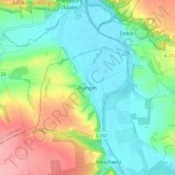
Name: Rumpin topographic map, elevation, terrain.
Location: Rumpin, Salzatal, Saalekreis, Saxony-Anhalt, Germany (51.58165 11.72935 51.62165 11.76935)
Average elevation: 348 ft
Minimum elevation: 217 ft
Maximum elevation: 604 ft
Thank you for supporting this site ❤️
Make a donation
Make a donation
Gear up for your next adventure:
As an Amazon Associate, this site earns from qualifying purchases at no extra cost to you.