Dahiwad topographic map
Interactive map
Click on the map to display elevation.
About this map
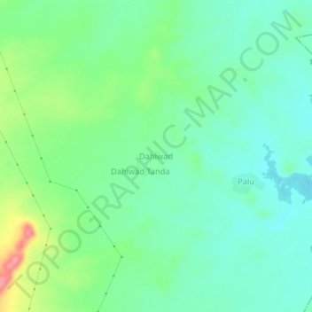
Name: Dahiwad topographic map, elevation, terrain.
Location: Dahiwad, Pusad, Yavatmal District, Maharashtra, India (19.80405 77.60329 19.84405 77.64329)
Average elevation: 1,079 ft
Minimum elevation: 988 ft
Maximum elevation: 1,296 ft
Other topographic maps
Click on a map to view its topography, its elevation and its terrain.
Harshi
India > Maharashtra > Pusad
Harshi, Pusad, Yavatmal District, Maharashtra, India
Average elevation: 1,224 ft
Nagwadi
India > Maharashtra > Pusad
Nagwadi, Pusad, Yavatmal District, Maharashtra, India
Average elevation: 1,401 ft
Asoli
India > Maharashtra > Pusad
Asoli, Pusad, Yavatmal District, Maharashtra, India
Average elevation: 1,102 ft
Shilona
India > Maharashtra > Pusad
Shilona, Pusad, Yavatmal District, Maharashtra, India
Average elevation: 1,227 ft
Bibi
India > Maharashtra > Pusad
Bibi, Pusad, Yavatmal District, Maharashtra, India
Average elevation: 1,368 ft
Kharshi
India > Maharashtra > Pusad
Kharshi, Pusad, Yavatmal, Maharashtra, India
Average elevation: 1,329 ft
Panhala
India > Maharashtra > Pusad
Panhala, Pusad, Yavatmal, Maharashtra, India
Average elevation: 1,775 ft