
Locust Grove topographic map
Click on the map to display elevation.
About this map
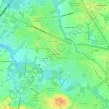
Name: Locust Grove topographic map, elevation, terrain.
Average elevation: 82 ft
Minimum elevation: 36 ft
Maximum elevation: 154 ft
Camden County trails, hiking, mountain biking, running and outdoor activities
Other topographic maps
Click on a map to view its topography, its elevation and its terrain.
Cherry Hill Mall
United States > New Jersey > Camden County > Cherry Hill Township
Average elevation: 52 ft
Cooper River Lake
United States > New Jersey > Camden County > Cherry Hill Township > Stoys Landing
Average elevation: 33 ft