Geolocate

Sainj topographic map

Click on the map to display elevation.

About this map

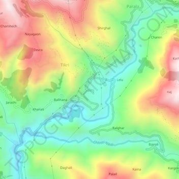
Name: Sainj topographic map, elevation, terrain.

Location: Sainj, Theog, Shimla District, Himachal Pradesh, India (31.05687 77.36876 31.09687 77.40876)

Average elevation: 5,000 ft

Minimum elevation: 3,940 ft

Maximum elevation: 6,486 ft

Gear up for your next adventure:

🪓Survival Multi‑Tool - Versatile tool for camp and trail tasks
🧥Waterproof Jacket for Hiking - Breathable and rugged rain jacket for outdoor excursions
👟Men's Trail Runners - Lightweight footwear for fast-paced exploration and light hiking
🧭Pro Hiking Compasses - High-accuracy liquid-filled compasses for topographic orientation
🚁Photography Drones - Capture stunning aerial views of landforms and topography

As an Amazon Associate, this site earns from qualifying purchases at no extra cost to you.