
Las Rozas topographic map
Interactive map
Click on the map to display elevation.
About this map
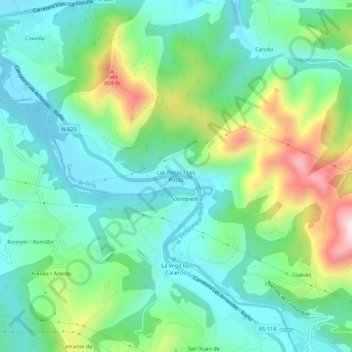
Name: Las Rozas topographic map, elevation, terrain.
Location: Las Rozas, Cangas de Onís, Asturias, 33540, España (43.35450 -5.17138 43.39450 -5.13138)
Average elevation: 509 ft
Minimum elevation: 85 ft
Maximum elevation: 1,591 ft
Other topographic maps
Click on a map to view its topography, its elevation and its terrain.
Cardes
España > Asturias > Cangas de Onís > Cangas de Onís
Cardes, Cangas de Onís, Asturias, 33589, España
Average elevation: 781 ft
Helgueras
España > Asturias > Cangas de Onís > Cangas de Onís
Helgueras, Cangas de Onís, Asturias, 33589, España
Average elevation: 709 ft