Geolocate

Lechang topographic map

Click on the map to display elevation.

About this map

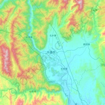
Name: Lechang topographic map, elevation, terrain.

Location: Lechang, Shaoguan, Guangdong Province, China (24.97368 113.18216 25.29368 113.50216)

Average elevation: 1,480 ft

Minimum elevation: 233 ft

Maximum elevation: 5,059 ft

Gear up for your next adventure:

🔭Stargazing Telescopes - Perfect for camping in low-light pollution areas shown on maps
🏔️Mountain Trail Maps - High‑detail maps for popular peaks
🖼️Topo Map Wall Art - Decorative topographic prints of famous peaks and regions
🌄Hiking Binoculars - Compact binoculars for scenic views and trail spotting
🚑Emergency Bivvies - Heat-reflective sleeping bags for survival situations

As an Amazon Associate, this site earns from qualifying purchases at no extra cost to you.