Apple Valley topographic map
Click on the map to display elevation.
Apple Valley
According to the United States Census Bureau, the city has a total area of 17.57 square miles (45.51 km2), of which 16.86 square miles (43.67 km2) is land and 0.71 square miles (1.84 km2) is water. The city's geography is rolling, with elevation from the lowest to the highest points in the city varying by one hundred feet (thirty metres) or more. The downtown area and its adjacent residential district (which formed the original core of the city when it was incorporated) are in a shallow valley.
About this map
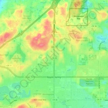
Name: Apple Valley topographic map, elevation, terrain.
Location: Apple Valley, Dakota County, Minnesota, 55124, United States (44.71734 -93.24835 44.77589 -93.15134)
Average elevation: 988 ft
Minimum elevation: 886 ft
Maximum elevation: 1,125 ft
Dakota County trails, hiking, mountain biking, running and outdoor activities
Other topographic maps
Click on a map to view its topography, its elevation and its terrain.

Burnsville
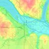
United States > Minnesota > Dakota County > Burnsville > Burnsville
Average elevation: 902 ft