
Thank you for supporting this site ❤️
Make a donation
Make a donation
Gear up for your next adventure:
As an Amazon Associate, this site earns from qualifying purchases at no extra cost to you.
Castillo topographic map
Click on the map to display elevation.
Thank you for supporting this site ❤️
Make a donation
Make a donation
Gear up for your next adventure:
As an Amazon Associate, this site earns from qualifying purchases at no extra cost to you.
About this map
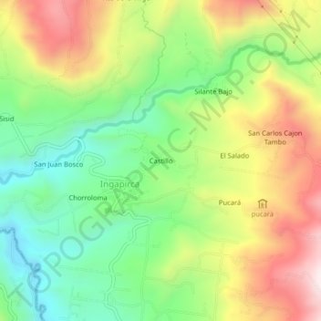
Name: Castillo topographic map, elevation, terrain.
Location: Castillo, Ingapirca, Cañar, Ecuador (-2.56127 -78.89161 -2.52127 -78.85161)
Average elevation: 10,551 ft
Minimum elevation: 9,616 ft
Maximum elevation: 11,814 ft
Thank you for supporting this site ❤️
Make a donation
Make a donation
Gear up for your next adventure:
As an Amazon Associate, this site earns from qualifying purchases at no extra cost to you.