
Thank you for supporting this site ❤️
Make a donation
Make a donation
Gear up for your next adventure:
As an Amazon Associate, this site earns from qualifying purchases at no extra cost to you.
Karıt topographic map
Click on the map to display elevation.
Thank you for supporting this site ❤️
Make a donation
Make a donation
Gear up for your next adventure:
As an Amazon Associate, this site earns from qualifying purchases at no extra cost to you.
About this map
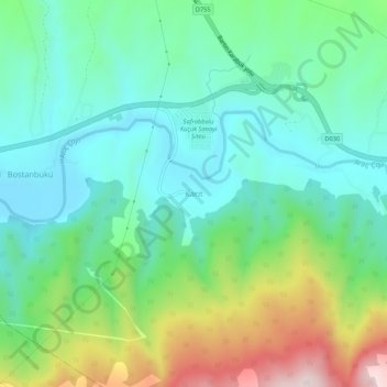
Name: Karıt topographic map, elevation, terrain.
Location: Karıt, Safranbolu, Karabük, Black Sea Region, 78050, Turkey (41.19325 32.68857 41.23325 32.72857)
Average elevation: 1,411 ft
Minimum elevation: 925 ft
Maximum elevation: 2,602 ft
Thank you for supporting this site ❤️
Make a donation
Make a donation
Gear up for your next adventure:
As an Amazon Associate, this site earns from qualifying purchases at no extra cost to you.