
Make a donation
Gear up for your next adventure:
As an Amazon Associate, this site earns from qualifying purchases at no extra cost to you.
Lake Julius topographic map
Click on the map to display elevation.
Make a donation
Gear up for your next adventure:
As an Amazon Associate, this site earns from qualifying purchases at no extra cost to you.
About this map
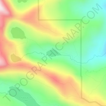
Name: Lake Julius topographic map, elevation, terrain.
Location: Lake Julius, Chelan County, Washington, United States (47.73543 -120.87870 47.73742 -120.87279)
Average elevation: 5,568 ft
Minimum elevation: 4,810 ft
Maximum elevation: 6,581 ft
Make a donation
Gear up for your next adventure:
As an Amazon Associate, this site earns from qualifying purchases at no extra cost to you.
Other topographic maps
Click on a map to view its topography, its elevation and its terrain.
Lake Chelan
United States > Washington > Chelan County > Chelan
Lake Chelan (/ʃəˈlæn/ shə-LAN) is a narrow, 50.5 mi (81.3 km) long lake in Chelan County, north-central Washington state, U.S. It is an overdeepened lake and resembles a fjord, with an average width of 1.3 mi (2.1 km). Near its upper end, the lake surface lies more than 6,600 ft (2,000 m) below peaks less…
Average elevation: 4,455 ft
Mount David
United States > Washington > Chelan County
Mount David is a prominent 7,420-foot (2,260-metre) mountain summit located in Chelan County of Washington state. The mountain is situated in the Glacier Peak Wilderness, on land managed by the Okanogan-Wenatchee National Forest. Mount David is the highest point of Wenatchee Ridge, a subrange which also…
Average elevation: 5,696 ft
Make a donation
Gear up for your next adventure:
As an Amazon Associate, this site earns from qualifying purchases at no extra cost to you.