
Thank you for supporting this site ❤️
Make a donation
Make a donation
Gear up for your next adventure:
As an Amazon Associate, this site earns from qualifying purchases at no extra cost to you.
Münz topographic map
Click on the map to display elevation.
Thank you for supporting this site ❤️
Make a donation
Make a donation
Gear up for your next adventure:
As an Amazon Associate, this site earns from qualifying purchases at no extra cost to you.
About this map
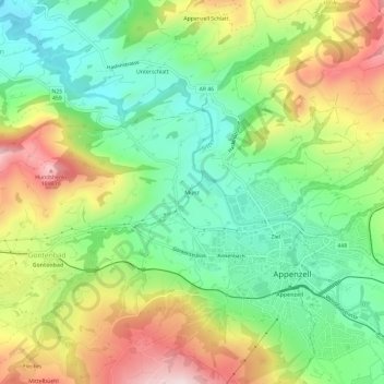
Name: Münz topographic map, elevation, terrain.
Location: Münz, Appenzell, Appenzell Innerrhoden, 9050, Switzerland (47.31846 9.37450 47.35846 9.41450)
Average elevation: 2,831 ft
Minimum elevation: 2,303 ft
Maximum elevation: 3,619 ft
Thank you for supporting this site ❤️
Make a donation
Make a donation
Gear up for your next adventure:
As an Amazon Associate, this site earns from qualifying purchases at no extra cost to you.