Geolocate

Heidelberg topographic map

Click on the map to display elevation.

About this map

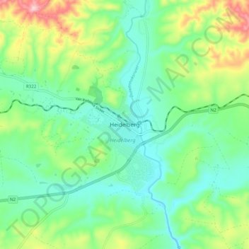
Name: Heidelberg topographic map, elevation, terrain.

Location: Heidelberg, George, Western Cape, 6665, South Africa (-34.12996 20.91859 -34.04996 20.99859)

Average elevation: 479 ft

Minimum elevation: 194 ft

Maximum elevation: 1,161 ft

Other topographic maps

Click on a map to view its topography, its elevation and its terrain.

Oudtshoorn

South Africa > Western Cape > George

Average elevation: 1,158 ft

Touwsranten

South Africa > Western Cape > George

Average elevation: 663 ft

Danabaai

South Africa > Western Cape > George

Average elevation: 358 ft

Oudtshoorn

South Africa > Western Cape > George

Average elevation: 1,158 ft

Friemersheim

South Africa > Western Cape > George

Average elevation: 860 ft

Oudtshoorn

South Africa > Western Cape > George

Average elevation: 1,158 ft

Garden Route Dam

South Africa > Western Cape > George

Average elevation: 656 ft

Gear up for your next adventure:

🧣Hiking Neck Gaiter - Multi‑use neck protection for outdoor weather
🎁Geography Themed Gifts - Unique gift ideas for map lovers and geography enthusiasts
🔋Rechargeable Batteries - Power up your outdoor devices
🛡️Insect Repellent - Protection against bugs during outdoor activities
🩳Quick‑Dry Hiking Shorts - Comfortable and quick‑dry shorts for summer hiking

As an Amazon Associate, this site earns from qualifying purchases at no extra cost to you.