Geolocate

Madera topographic map

Click on the map to display elevation.

About this map

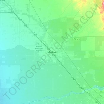
Name: Madera topographic map, elevation, terrain.

Location: Madera, Madera County, California, 93637, United States (36.80227 -120.21947 37.12227 -119.89947)

Average elevation: 285 ft

Minimum elevation: 171 ft

Maximum elevation: 1,004 ft

Madera County trails, hiking, mountain biking, running and outdoor activities

Gear up for your next adventure:

📚USA Hiking Guide Books - Top trail guides and map books
🌡️Handheld Weather Meters - Measure wind, temp, and pressure for safe mountain travel
🧭Pro Hiking Compasses - High-accuracy liquid-filled compasses for topographic orientation
🪄Magnetic Compass - Accurate compass for navigation
🗺️NatGeo Topo Maps - High-quality waterproof printed topographic maps of US Parks

As an Amazon Associate, this site earns from qualifying purchases at no extra cost to you.