Geolocate

Kangra topographic map

Click on the map to display elevation.

About this map

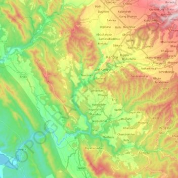
Name: Kangra topographic map, elevation, terrain.

Location: Kangra, Himachal Pradesh, India (31.97306 76.16873 32.16417 76.37064)

Average elevation: 2,208 ft

Minimum elevation: 1,339 ft

Maximum elevation: 3,422 ft

Gear up for your next adventure:

🔋Solar Power Banks - Keep your GPS and phone charged in remote wilderness areas
🛡️Bear Spray Outdoor - Protection in bear country hikes
🌐World Map Poster - Decorative world maps with topographic info
Camping Coffee Makers - Enjoy premium coffee at the summit or campsite
🛌Ultralight Sleeping Bags - Compact down bags for cold nights in the wilderness

As an Amazon Associate, this site earns from qualifying purchases at no extra cost to you.